Category: Uncategorised

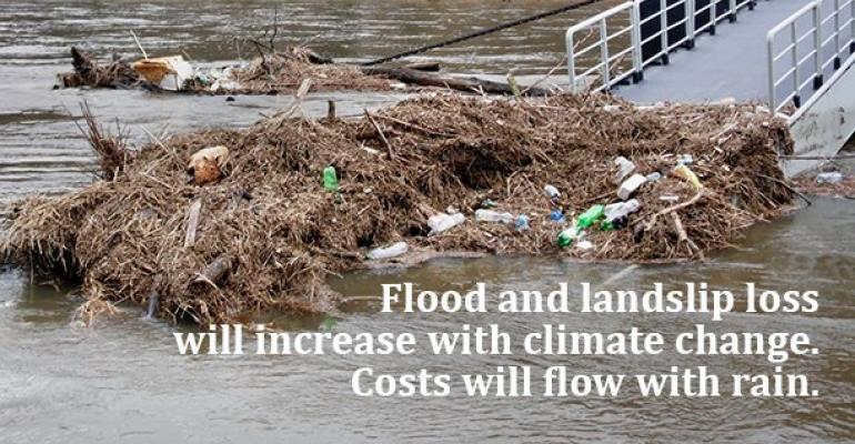
New reports highlight flood risk under climate change

Two reports released today by NIWA and the Deep South National Science Challenge reveal new information about how many New Zealanders, how many buildings and how much infrastructure could be affected by extreme river and coastal flooding from storms and sea-level rise.

One report looks at what would happen when rivers are flooded by heavy rain and storms, while the other examines flooding exposure in coastal and harbour areas and how that might change with sea-level rise.

NIWA researcher Ryan Paulik says the New Zealand Fluvial (river) and Pluvial (rainfall) Flood Exposure report is a first cut at identifying the amount of exposure to flooding at a national scale based on available flood maps.

Their findings show that across the country almost 700,000 people and 411,516 buildings worth $135 billion are presently exposed to river flooding in the event of extreme weather events. With climate change, more extreme rainfall events are expected to occur – but weren’t covered in this report.  Also exposed are 19,098 km of roads, 1574km of railways and 20 airports.

Urgent need for national flood risk maps

The information was put together using a range of flood maps and data published by local authorities, central government organisations, Crown Research Institutes and Land Information New Zealand. However, Mr Paulik says while the information used was the best publicly available, it varied in detail and age, which means the findings are general and should only be used as a first nationwide estimate.

Mr Paulik says the research has revealed an urgent need for national flood risk maps.

“National flood risk maps are essential because we need accurate and comprehensive information about the impact and costs of flooding today and under different climate change scenarios so everyone can plan and adapt.”

A range of technical recommendations have been made to central government about how the national maps could be produced.

Coastal flooding exposure under future sea level rise

The second report, Coastal Flooding Exposure Under Future Sea Level Rise, looks at extreme storm-tide flood levels (one-in-100 year flood events) combined with various sea levels up to 3 metres higher than they are today.

Mr Paulik and Dr Rob Bell modelled coastal floods that can occur when a storm surge coincides with a large high tide to cause extreme flood heights. This scenario must be planned for under the New Zealand Coastal Policy Statement.

The sea-level rise modelling builds on flood mapping work undertaken by the Parliamentary Commissioner for the Environment (PCE) in 2015. The PCE study used Mean High-Water Spring (the highest level that spring tides reach on average) as a baseline and did not take in account flooding during an extreme storm. Mr Paulik and Dr Bell have replaced this measure with a one-in-100 year extreme sea level event such as an ex-tropical storm or major storm. They then assessed the risk exposure for 10 cm increments of sea-level rise up to 3 metres.

Over 70,000 New Zealanders currently at risk

This second report shows 72,000 New Zealanders currently exposed to present-day extreme coastal flooding, along with about 50,000 buildings worth $12.5 billion. The risk exposure increases markedly with sea-level rise, particularly during the first metre of rise, which means long-term planning to address the risk is urgent.

There is near certainty that the sea will rise 20-30 cm by 2040. By the end of the century, depending on whether global greenhouse gas emissions are reduced, it could rise by between 0.5 to 1.1 m, which could add an additional 116,000 people exposed to extreme coastal storm flooding.

Dr Bell said it was important for councils addressing coastal adaptation to prioritise the areas most at risk but also to undertake regional 100-year risk assessments to inform where land-use planning restrictions are put in place to limit future intensification – even if coastal flooding was some years away.

“We need to put the brakes on development in coastal areas even if areas may not be impacted for a few decades – given sea level will continue rising,” he said. Read the reports at the project page here: https://www.deepsouthchallenge.co.nz/projects/national-flood-risks-climate-change

Sea level rise and river flooding: flood risk under climate change

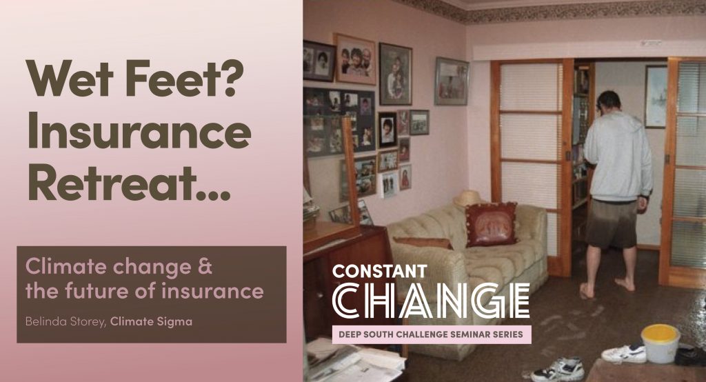
A man standing outside his house in knee-high water

Two reports released today by NIWA and the Deep South National Science Challenge reveal new information about how many New Zealanders, how many buildings and how much infrastructure could be affected by extreme river and coastal flooding from storms and sea-level rise.

One report looks at what would happen when rivers are flooded by heavy rain and storms, while the other examines flooding exposure in coastal and harbour areas and how that might change with sea-level rise.

NIWA researcher Ryan Paulik says the New Zealand Fluvial (river) and Pluvial (rainfall) Flood Exposure report is a first cut at identifying the amount of exposure to flooding at a national scale based on available flood maps.

Their findings show that across the country almost 700,000 people and 411,516 buildings worth $135 billion are presently exposed to river flooding in the event of extreme weather events. With climate change, more extreme rainfall events are expected to occur – but weren’t covered in this report.  Also exposed are 19,098 km of roads, 1574km of railways and 20 airports.

Urgent need for national flood risk maps

The information was put together using a range of flood maps and data published by local authorities, central government organisations, Crown Research Institutes and Land Information New Zealand. However, Mr Paulik says while the information used was the best publicly available, it varied in detail and age, which means the findings are general and should only be used as a first nationwide estimate.

Mr Paulik says the research has revealed an urgent need for national flood risk maps.

“National flood risk maps are essential because we need accurate and comprehensive information about the impact and costs of flooding today and under different climate change scenarios so everyone can plan and adapt.”

A range of technical recommendations have been made to central government about how the national maps could be produced.

Coastal flooding exposure under future sea level rise

The second report, Coastal Flooding Exposure Under Future Sea Level Rise, looks at extreme storm-tide flood levels (one-in-100 year flood events) combined with various sea levels up to 3 metres higher than they are today.

Mr Paulik and Dr Rob Bell modelled coastal floods that can occur when a storm surge coincides with a large high tide to cause extreme flood heights. This scenario must be planned for under the New Zealand Coastal Policy Statement.

The sea-level rise modelling builds on flood mapping work undertaken by the Parliamentary Commissioner for the Environment (PCE) in 2015. The PCE study used Mean High-Water Spring (the highest level that spring tides reach on average) as a baseline and did not take in account flooding during an extreme storm. Mr Paulik and Dr Bell have replaced this measure with a one-in-100 year extreme sea level event such as an ex-tropical storm or major storm. They then assessed the risk exposure for 10 cm increments of sea-level rise up to 3 metres.

Over 70,000 New Zealanders currently at risk

This second report shows 72,000 New Zealanders currently exposed to present-day extreme coastal flooding, along with about 50,000 buildings worth $12.5 billion. The risk exposure increases markedly with sea-level rise, particularly during the first metre of rise, which means long-term planning to address the risk is urgent.

There is near certainty that the sea will rise 20-30 cm by 2040. By the end of the century, depending on whether global greenhouse gas emissions are reduced, it could rise by between 0.5 to 1.1 m, which could add an additional 116,000 people exposed to extreme coastal storm flooding.

Dr Bell said it was important for councils addressing coastal adaptation to prioritise the areas most at risk but also to undertake regional 100-year risk assessments to inform where land-use planning restrictions are put in place to limit future intensification – even if coastal flooding was some years away.

“We need to put the brakes on development in coastal areas even if areas may not be impacted for a few decades – given the sea level will continue rising,” he said.

We need to put the brakes on development in coastal areas even if areas may not be impacted for a few decades – given the sea level will continue rising.

Rob Bell, NIWA

DSC Seminar | Sea level rise PLUS big storms: What exactly are we in for?

Councils across New Zealand are declaring climate emergencies. But what climate information are they using to make their decisions and inform their communities? In this seminar, we’ll hear from Ryan Paulik and Rob Bell (NIWA), whose ground-breaking research investigates how flooding will get worse under climate change – both at the coast and inland, alongside our rivers.

Recent cyclones have shown us how vulnerable we all are to extreme weather – whether we’re living on the coast or inland in a flood-plain.

But what happens when you add 10cm or 30cm or 1m of sea level rise to the picture? Or when big rain events hit rural areas, or towns, or cities, that may not have been hit so badly before?

The research builds on and improves national flood mapping carried out by the Parliamentary Commissioner for the Environment in 2015, and provides a comprehensive picture of the impact of coastal and inland flooding on our national infrastructure, including our buildings, roads, railways, airports, electricity transmission lines, water infrastructure and farms.

Due for release in September, the research is presented in two reports. The first describes what infrastructure will be exposed for every 10cm of sea level rise (up to 3m), including when coupled with one-in-100-year storms. For example, 30 centimeters of sea level rise (foreseeable in the next 30 years) would expose $18.49 billion worth of buildings around New Zealand to flooding. Further, 2,000 kms of roads, 112 kms of railway tracks, 4,000 kms of water pipelines, 1,600 sq kms of agricultural land, 14 domestic / international airports would also be exposed. Slide up to 1m of sea level rise, and the dollar value of exposure increases to $39 billion.

The second report maps inland flood risk against infrastructure, and finds, for example, that a staggering $135 billion worth of buildings are potentially exposed. Add to this almost 19,000 kms of roads, 1,500 km of railway tracks, 21,173km of water pipelines, 3,397 km of national grid transmission lines and 20 airports, and you begin to get a sense of the challenges ahead of us. But if we can accurately predict the areas of highest risk, we can better adapt, minimising harm to New Zealand’s population and economy.

Come and gain an overview of these reports in advance of release, understand the limitations of the data and the team’s recommendations for further research.

This research will support further development of RiskScape (open access software developed by NIWA and GNS Science), which can directly help those people whose job it is to manage flood risk.

Physical hubs: 
  • NIWA Wellington: Conference Room*
  • NIWA Christchurch: TerraNova Room
  • NIWA Lauder: Computer Room
  • University of Canterbury: Meremere 411
  • School of Law Building: University of Otago:
  • Conference Room (Room 314): Physics Department

*Our presenters will be speaking from this hub.

Please note, all visitors to NIWA must sign in on arrival.

We encourage you to set up your own hub and bring friends and colleagues together to participate in the seminar. Please let us know if you do set up your own hub.

Email: [email protected]

What the MV Rena grounding and climate adaptation have in common: Treaty of Waitangi obligations

In the aftermath of the MV Rena grounding in the Bay of Plenty, complaints were taken to the Waitangi Tribunal and the Environment Court about the way local and central government handled the disaster.

Once the Rena had stranded on Otaiti (Astrolabe Reef), the Crown acted quickly – making decisions about if, how and when to remove the wreck. In its haste, it overlooked its Treaty of Waitangi obligations to actively protect and partner with mana whenua. The Tribunal found that the Crown had breached the Treaty, and in particular let iwi down by not facilitating consultation – putting at risk “their ability to engage meaningfully in the resource consent [RMA] process.”

New research, led by Catherine Iorns (Victoria University of Wellington) and funded by the Deep South Challenge: Changing with our Climate, explores the Crown’s potential liability under the Treaty of Waitangi for decisions about how we might adapt to climate change. The research suggests that the MV Rena decision, along with other key case studies, provides guidance for the Crown about its Treaty duties in relation to climate adaptation decision-making.

It finds, for example, that the Crown should not create policies and laws that undermine the ability of iwi to protect the whenua (land). In the case of climate adaptation, this is difficult, because while this duty is on the Crown, many – if not most – climate adaptation decisions are currently being made by local and regional councils under the Resource Management Act (RMA). Further, as with the MV Rena, the Treaty obligations of active protection and partnership, especially the facilitation of consultation, will apply, even in commercial negotiations with an overlay of confidentiality and urgency.

The research explores five case studies (at Matatā, the Hawkes Bay, Mōkau River, Waitara and in Whaingaroa/Raglan), and concludes that central government should be playing more of a role in guiding local government decision-making processes, to ensure the Treaty principles of partnership, governance, reciprocity, active protection, good faith, consultation and development are followed in climate adaptation decision-making processses.

Active protection suggests the maintenance of Māori relationships with the coast. Iorns’ research finds that central government funding (as the Treaty partner) should therefore first be directed towards maintaining these relationships.

Where managed retreat needs to be discussed, especially from ancestral lands, tangata whenua will likely need to involved as equal partners in decision-making – a relationship involving more than “significant consultation” by the Crown. If there is to be managed retreat from the coast, relationships with traditional territories would still need to be maintained even in the absence of ownership. For that, access to coastal territories would be required.

The climate adaptation measures needed both now and in the future will likely have significant implications for the protection of iwi taonga/assets under Article 2 of the Treaty of Waitangi. Iorns finds that central and local government need to keep in mind the wider picture of upholding Treaty principles, rather than the minimum conditions in the RMA, in order to avoid modern Treaty breaches in relation to these assets. This necessarily implies that more attention must be paid to factual and legal issues in this area, to ensure that the Treaty of Waitangi is upheld, as we change in time for our changing climate. Please find the full report and more information about Catherine Iorns’ research here.

Councils, Communities and Climate Change Adaptation

This three-part webinar series draws from the Climate-Adaptive Communities research project of the Deep South Challenge.

Climate change is already impacting councils and communities  Around New Zealand, people are starting to grapple with the challenges of increasing sea levels, groundwater levels, and more severe flood events. As well as impacting on infrastructure, these will have significant societal implications both in the short term and long term. In the near future, many councils will need to start engaging with exposed communities about what this might mean. 

This three-part webinar series draws from the Climate-Adaptive Communities research project of the Deep South Challenge. The research included a survey of councils and case studies of several local authority areas that are exposed to climate change impacts. We looked at how councils are engaging with their communities, how communities (especially those more susceptible to harm) may be affected, and what adaptation initiatives are already being undertaken by iwi and communities. 

Director of the Centre for Sustainability Dr Janet Stephenson, along with Grace Hall, Sophie Bond, and Gradon Diprose will be your presenters on these essential topics. 

Presented in partnership with the Deep South Challenge, these webinars are offered free of charge.

Furthermore, as part of this work we have produced 2 short videos, a council briefing document, and a cartoon, to help in conveying key messages to a broad audience of councils, communities, and government. These are available to be part of the package of webinars.

To register for this series, please email [email protected]. Click the links below to find out more about each webinar. 

Community development for climate adaptation: Long-term relationships key in painful conversations

Cartoon frame

To minimise suffering as we adapt to climate change, and to adapt successfully, local authorities need new ways to engage with communities.

Every regional council in the country, and over a quarter of our local councils, face extreme exposure to climate hazards like coastal erosion, flooding and rising groundwater levels.

Over the coming years, communities will have to make near-impossible decisions – from how to pay for expensive coastal defence systems to when we should think about picking up our survey pegs and walking backwards from the coastline.

Communities will face increasing physical, social, financial and emotional challenges, and councils are already looking to central government to provide a cohesive framework for the planning and funding of adaptation. But to minimise suffering as we adapt – and to adapt successfully – local authorities also need new ways to engage with communities.

Recently concluded research by a team led by Janet Stephenson (University of Otago), draws on stories and insights from community members, iwi members and council staff. Their project findings suggest that council engagement with communities about climate impacts requires more than ‘business as usual’ engagement processes, because:

  • Adaptive decisions will need to be made at many points in time, probably over decades
  • These decisions often have to be made without a full understanding of what the future holds
  • Multiple individual decisions could result in inequitable outcomes, unless council has an overview of implications for the entire community
  • The community members most severely affected may well be those who are least empowered and least accustomed to ‘having a say’ in council decisions
  • It takes time to build the trust and capacity to be involved in decisions that have such far-reaching implications.

This research enriches the existing MfE Coastal Hazards and Climate Change Guidance by providing advice for councils and community groups on how and when to engage on climate change. The guidance recommends a Dynamic Adaptive Pathways Planning (DAPP) approach to engagement, by which critical decision points for adaptation investments are pre-defined.

This framework supports local government staff (from adaptation advisors to community development teams to community groups themselves) to build community readiness to engage at these critical decision points. It also provides tools for those who want to organise together to build resilience:

  • A survey and report of councils, which explores why councils find it so challenging to meaningfully engage (background report for researchers or those seeking more in-depth information)
  • Policy guidance (including engagement framework) for local government adaptation and community development staff

Conversation starters for community engagement staff:

  • Short graphic story introducing two young friends who live in a community affected by climate change. The pair reveal how devastating climate change can be and begin to understand the strength communities have when they work together on solutions
  • Two short videos based in South Dunedin, one exploring a neighbourhood’s response to the 2015 floods and subsequent events; the other exploring Dunedin City Council’s response and move towards proactively planning for climate hazards.

Change is nothing new in Te Hiku o te Ika

The iwi of Te Hiku o Te Ika are concerned about the impact of climate change on household drinking water. Results from this research, grounded in three rural Northland communities, have now been published in MAI: A New Zealand Journal of Indigenous Scholarship.

Isolation in the Far North means that roof-fed tank systems are the predominant source of drinking water for these communities. Understanding how climate change will impact water supplies has helped these communities prepare for the future, prioritise actions and mitigate detrimental effects.

The large research team led by Wendy Henwood of Te Rarawa included mana whenua community researchers at each location, iwi members, the Whāriki Research Group (Massey University), ESR and NIWA. Community researchers recorded daily rainfall and temperature data, surveyed household drinking water infrastructure and monitored water quality by taking household samples. NIWA and ESR team members used the data to model climate change scenarios and E.Coli contaminations, and kaumatua contributed mana whenua views.

The project highlighted the potential impacts of the general “hotter, drier” climate predictions for Te Hiku on the security and safety of drinking water supplies. Overall lower rainfall suggested the need for greater tank storage volumes. However, increased ambient temperatures are likely to converge with longer storage periods, to increase the pathogen count in these drinking water stores.

Throughout the research, practical strategies and innovations were shared about how to minimise water contamination, including about where to place septic tanks, how to protect water sources, the need for possum and rat trapping programmes, the importance of regular maintenance and upgrades, and de-sludging tanks. First flush diverters, UV treatment, and filters were described as solutions to improve water quality in some situations. Communities were acutely aware of the need to store more water and this, as well as the need for infrastructure upgrades at a number of households, all involve cost.

While the research focused on household drinking water, the issue was not viewed in isolation. Water is part of the environment, the people, and a whakapapa to Ranginui and Papatūānuku. Fresh and salt-water are the basis for land-use decisions (farming, gardens, orchards, fishing). Lifestyles revolved and revolve around its catchment. By creating specific, located, Māori knowledge about water sustainability, as a key dimension of community viability, this project has kick-started preparations in Te Hiku for the effects of climate change on people, ecosystems, lands and economy.

Quotes from kaumātua are woven throughout the final research report (see below) and are a moving testimony to the wealth of mātauranga Māori held in Te Hiku about our changing climate.

Local kaumatua have always observed and lived by the weather, practised kaitiakitanga, and acknowledged water’s vital interconnectedness with the environment. These elders are not fazed by the impact of climate change. Their resilience stems from a lifetime of working with the weather, growing up valuing water, and having the necessary knowledge and life skills to adapt to changing situations and realities. Theirs is an attitude that broader New Zealand could learn much from.

An article on the research, Enhancing drinking water quality in remote Māori communities, has just been published in MAI Journal. Read the final research report here.

*BOOKED OUT* DSC Seminar | Community Development for Adaptation: Council-community engagement

More and more of New Zealand’s urban settlements are likely to be impacted by climate hazards such as coastal erosion, flooding and rising groundwater levels. Affected communities will face physical, social, financial and emotional challenges. 

To minimise suffering in our communities as we adapt to climate change – and to adapt successfully – local authorities will need to adopt new approaches to engagement with communities. We invite you to participate in our next Deep South Seminar, with Janet Stephenson (University of Otago), who leads the project, “Climate adaptation, vulnerability and community well-being.”

This seminar reflects on some of the research findings of the Climate-Adaptive Communities project, which draw on stories and insights shared with the research team by community members, iwi members and council staff. 

The team’s early findings suggest that the way councils engage with their communities about climate change impacts must necessarily be different from ‘ordinary’ engagement processes, because:

  • Adaptive decisions will need to be made at many points in time, probably over decades
  • These decisions must often be made without a full understanding of what the future holds (i.e. lacking a strong evidence-base with high levels of uncertainty)
  • Multiple individual decisions could result in inequitable outcomes unless council has an overview of implications for the entire community
  • The community members most severely affected may well be those who are least empowered and least accustomed to ‘having a say’ in council decisions
  • It takes time to build the trust and capacity to be involved in decisions that have such far-reaching implications

The research also suggests that councils should start to engage with at-risk communities early, before they begin to experience severe impacts, by:

  • Helping communities to understand the upcoming challenges
  • Helping to strengthen people’s ability to ‘have a voice’ in decisions that will affect them, particularly those who are less powerful or more susceptible to harm
  • Helping build community resilience to deal with current and future stresses
  • Helping ensure the community has sufficient trust, confidence and capacity to fully engage with councils for key decisions on the adaptive journey.

The Ministry for the Environment recommends a Dynamic Adaptive Pathways Planning (DAPP) approach, which involves pre-defining critical decision points for adaptation investments (and which is also the subject of other research underway in the Deep South Challenge). A community development approach can underpin DAPP, by building community readiness to engage at these decision points.

Location

PLEASE NOTE, THIS SEMINAR IS NOW OVERSUBSCRIBED. WE ENCOURAGE YOU TO ATTEND A PHYSICAL HUB, OR TO JOIN YOUR COLLEAGUES TO WATCH FROM THE SAME COMPUTER.

Physical hubs: 
  • University of Otago: Centre for Sustainability Seminar Room, 563 Castle Street North*
  • NIWA Wellington: Conference Room
  • NIWA Christchurch: Tekapo Room
  • University of Canterbury: Meremere  411, School of Law building

*Our presenter will be speaking from this hub.

Please note, all visitors to NIWA must sign in on arrival.

We encourage you to set up your own hub and bring friends and colleagues together to participate in the seminar. Please let us know if you do set up your own hub.

Email: [email protected]

Now seeking expressions of interest for Programme Lead, Processes & Observations

Expressions of interest are being sought for Challenge Leadership Team (CLT) role of Processes and Observations Programme Leader in the Deep South Challenge: Changing with our Climate. Applications close Friday 12 July 2019.

The Challenge undertakes and coordinates research to achieve its mission of “enabling New Zealanders to anticipate, adapt, manage risk, and thrive in a changing climate.” The Challenge has been renewed for Phase 2 (2019-2024) and is currently establishing its portfolio of research across Climate Modelling, Observations for Model Development, and the Challenge’s four Domains (Māori, Communities, Infrastructure, and the National Economy).

Each science project team works with key partners and stakeholders (researchers and end-users) to co-create, develop, implement, and disseminate research findings within, and across, each science programme.  Integration with other climate-relevant New Zealand research programmes is also a priority.

The Processes and Observations Programme Leader position will provide critical science and planning support to the Deep South Challenge. You will draw on your extensive national and international knowledge and research networks to ensure the wider Challenge research programme contributes to the mission. You will work closely with the Deep South Challenge team to ensure Observational based research is integrated within the Challenge, and will strengthen and develop relationships with stakeholders, end users, other research providers and other research programmes, including the Antarctic Science Platform and the other National Science Challenges. A clear vision of the pathway from science to impact will be necessary to achieve the Challenge’s mission.

Our Observations for Model Development which will be led by Processes and Observations Programme Leader builds on the successful Phase One Processes and Observations programme while aiming to further integrate with other challenge research. Initial Phase Two projects will be contracted shortly, while further research will be developed following identification of the observational science which will be most relevant to answering the Challenge’s mission.  

The successful applicant will have the exciting opportunity to be part of the process to define our research in Phase 2.  We therefore require a strategic thinker, who can operate effectively as part of a team and assist in pulling together multidisciplinary research teams. The successful applicant will also be able to demonstrate extensive experience in co-creating research in close collaboration with stakeholders.

Up to 0.25 FTE is available for this position, for an initial two year appointment from 1 September 2019, with the possibility of continuing by mutual agreement.

The CLT is led by the Challenge Director and comprises the Challenge Manager, and one representative for each of the five Challenge Programmes. The Director reports to the Deep South Challenge Governance Group. Our other advisory groups include the Kāhui Māori, Independent Science Panel and a Representative User Group.

Please submit your CV together with a covering letter outlining your experience and interest in the role to the Challenge Manager, Anne-Marie Rowe, [email protected] by no later than 5 pm Friday 12 July 2019. 

For more information regarding this position, contact the Challenge Director, Dr Mike Williams ([email protected], +64-4-386-0389).

The Living Net: Kai in a Changing Climate

I MEET PETER INSLEY on a low promontory that rests above the Hāparapara River. Kids have built a rickety jumping platform in the pūriri and mānuka above us, but the water below – blue and glistening – looks treacherous. It’s hard to gauge the depth or see the snags. The river has always behaved like this. It beelines out of the hills and hits this hard rock, pooling and gathering before sweeping off again towards Omaio Bay in the Eastern Bay of Plenty.

Peter Insley above the Hāparapara.

In the days of Peter’s childhood, the river flats and coastal terraces of Omaio were in sheep and beef, which the community worked collectively. His parents and grandparents, and their peers, chose to take water from this location, installing a pipe and pump to serve their farming operations.

Today, it’s once more the site of close environmental monitoring. The whānau of Omaio again need water. They need drinking water, for people’s homes and for their marae. And they need water to realise their development plans, which include planting out the kinds of crops that attract top-dollar on local and international markets. They need to know if their rivers can sustain them, especially as the climate changes.

“This summer,” says Peter, cautious to speak at first, “we haven’t had much rain. One of our rivers, Tikinui, the whole length of it dried out, that’s about three kilometres.” It’s never happened before to Peter’s knowledge, and he’s been up in the hills since he was a boy. He seems to wear these waterways, this bush, all over him. He’s ahi kā, and while he’s in high demand across the motu, he has no interest in leaving.

Peter Insley is the man on the ground in the Deep South Challenge Vision Mātauranga project, “Climate-friendly, high-value crops for the whānau of Omaio.” A partnership between Te Rau Aroha Trust and NIWA, the project is supporting Omaio landowners to learn more about their water, their weather and their changing climate.

This project represents one piece of a complex puzzle the whānau need to solve before they decide which crop to invest their precious time and resources into. Other puzzle pieces include the shifting appetites of export markets, changing regulatory requirements, whānau buy-in, and the imperative that landowners consider multiple land-use options to build and maintain resilience.

At the moment, kiwifruit is looking like Te Rau Aroha’s most likely choice. But frosts are becoming fewer and far between, spring’s arriving earlier and vines are flowering sooner, our days are warming up, summers are becoming longer and drier, pest and disease profiles are changing, the wind’s increasing in strength and storms are getting worse, as floods waters wrestle with the rising seas. The Trust needs to be certain that the crop they choose, and even the cultivar, will be sustainable for at least the next 20 to 30 years.

The project is providing the community of Omaio with the tools and the training to monitor essential climate, weather, hydrology and soil data – so they can better consider and respond to changing climatic conditions – now and into the future.

ON THE 19TH of every month, Peter comes to the Hāparapara to test the water. At 7am – later than Peter would ordinarily start – I find him wading back and forth across the river, testing for water flow, sediment, e-coli, phosphates and nitrates.

By every measure, the river is clean, despite inputs from logging and other activities.

“Yep,” Peter chuckles. “I drink it and I’ve never gotten sick. I haven’t heard of anyone dying from it. The pigs, the deer, the birds and bees, they all drink it. Up river,” Peter gestures towards the mountains in the distance, “there’s big, healthy shags nesting, those noisy plovers, and kōtuku.”

The high bush is also home to a community of kōkako, which need constant predator protection by Peter and others.

The terraced fields of Omaio step gently up from the coast until they’re blocked by towering, bush-covered hills. This is Te Whānau a Apanui country, highly fertile and mostly still in Māori ownership – not such a common combination in modern-day Aotearoa.

Unlike the highly developed blocks in the Western Bay of Plenty, the remote coastline here is planted mainly in maize – stock feed – on land leased by landowners to growers from out of town. What whānau (represented by various small trusts) earn from their land only just covers the rates.

“It’s rubbish stuff,” says Chris Karamea Insley, Peter’s brother, and a trustee of Te Rau Aroha. “It’s low-value, and it brings the rats. Come out here with night glasses on, you’ll see rats everywhere.” Maize provides no local employment and contributes nothing to the local economy.

Still, the land feels lush and clean – more sheltered than Te Tairāwhiti round the cape, and less commercial than the country I drove through from Tauranga (on a coastal road that in parts was falling away, the result of coastal erosion and remnant Pacific cyclones). Whakaari is a constant smoking presence on the horizon. It feels quiet and peaceful, but Karamea is adamant that I look deeper.

Here in Omaio, there’s no mobile reception. There’s only one shop, but it no longer sells the saddles, dynamite or fresh produce it sold back before New Zealand’s export market for wool and meat dried up, and one generation and then another moved to the city in search of work. Unemployment and its associated strife is high.

Like a logging truck, you could barrel through Omaio, seeing and hearing nothing except the sound of your own engine.

We spend a moment talking about the differences between today and the Omaio of Peter and Karamea’s childhood.

“Unemployment?” Peter laughs. “That’s not a word that ever entered anyone’s brain. If you weren’t helping out your grandfather, grandmother, uncle, your mum or dad, well you were down the road helping someone else out – hay baling, sheep, whatever. It was communal, everyone helped. No one ever really got paid… so I guess we didn’t know about full employment either…!

“In those days,” Peter nods at our photographer, “everyone’s names were together. Down the marae, we all scratched our names into the wood. No one ever took a photo, you didn’t need to. Everyone was around, everyone was busy, we were always active, out in the garden… When we weren’t doing that we were fishing, swimming, diving, roaring [for deer], taking the dogs to go hunting for pigs or possums. The old ones, even to relax they’d sit down and do their weaving. There was never an idle moment.”

They want to come home. And science will be the enabler.

Chris Karamea Insley

Peter and Karamea hope, and have good evidence to support their hopes, that shifting into high-value crops will generate enough jobs and other activity in the local economy to bring whānau home.

“They want to come home,” says Karamea. “And science will be the enabler.”

AT THE HĀPARAPARA, Peter tests the water manually, but on other key sites throughout Omaio, environmental monitoring is being automated.

Karamea takes me to visit a land block owned by Te Rau Aroha, which the Trust hopes will become the first whānauowned and managed orchard in Omaio. The paddock is lying fallow at the moment. The trustees negotiated a rates abatement with council, for the period in which they need to plan and then to plant.

We scramble off the edge of the block into a dark, bush-clad gully – kō Wherurere te ngahere. Pīwaiwaka lead and follow us down the soft earth track. The Mitiwai stream cuts through the rock – a trickle when we find it, but the steep sides of the gully show us what can happen in big rain.

Te Rau Aroha are looking to have a covenant placed over this gully. Restricting the water they themselves can take, and locking future generations into careful water usage, means any irrigation will have to depend on careful planning and finely tuned water storage.

Peter and the NIWA technicians have been here long before us, installing a water pressure gauge and embedding markers in the rock from which the height of the stream is measured. Up in the paddock, roped off and in full sun, a sophisticated weather station gathers this and other information from Omaio’s various monitoring sites – soil temperature and soil moisture, rainfall, wind strength and solar radiation. Once a day, the entire data set is beamed, via satellite, to the NIWA office in Christchurch.

The NIWA team are building an online dashboard, accessible via smartphone, which gives Peter and others at Omaio real-time access to their environmental information.

NIWA hydrologist MS Srinivasan gives me a virtual tour, showing me how the tool will help whānau make on-the-fly decisions about irrigation and fertiliser use – maximising water availability for the plants and minimising environmental harm. The tool also integrates historical weather and soil moisture data, to give an accessible picture of how the soil in each location behaves when it rains, and provides weather and climate forecasting.

As the project moves forward, whānau members will be trained in how to use the tool to inform decision making around the use of water, for commercial and community purposes.

Such comprehensive data, coupled with other climate and scenario modelling, including for Bay of Plenty kiwifruit, means the whānau can work with crop specialists (Plant and Food, for example) to assess the strengths and vulnerabilities of one crop over another.

BUT SUCH AN INTIMATE analysis of local conditions, and the development of technology to capitalise on those conditions, is not new in Omaio.

Danny Poihipi is a renowned Te Whānau a Apanui fisherman and gardener, and an expert in the tikanga that governs these practices. His vast knowledge of the Omaio environment guides the Insley brothers, and the Trust, in their decision-making processes.

Danny arrives at the Insley family homestead bearing two mismatched pears and a loosely woven kete, which he places beside him. A silver plait slips down his neck. We have a cuppa before starting – our tea cups clink as we add sugar and long-life milk. Once he begins speaking, other priorities fall away.

“The rūnanga,” Danny tells us, “gave me some kaupapa to carry. I carry them out to the best of my ability. One thing for me is sustainability, through old technology, or new technology.” Danny’s first language is Māori, and it takes my Pākehā ears a while to settle into Danny’s rhythm, which ebbs and flows around his subject like the incoming tide.

“Trying to upkeep and uphold our unbroken chain, from our forefathers to us today. First the culture, the preservation of our culture, [then] the growing of our food and the keeping of our technology.”

At first the strands of Danny’s kōrero seem disparate, but with time he weaves them together. He circles back again. “We’ve got an unbroken chain from our atua horihori, our atua Māori… We have an idea for them in the garden, Rongomatāne and Haumietiketike. They look after all the fern root crops, and ngā hua whenua, that’s the food on top of the ground.”

I ask Danny what he thinks about kiwifruit.

But he’s a master storyteller, and won’t be drawn by direct, mundane questions. Instead, he makes a fishing net out of his words.

He picks up one of the pears. “There were no apples and peaches and plums and grapes here, so our people ate a lot of kiekie, one was the fruit, and one was the flower they ate, the tāwhara. And the teure is the cone of the kiekie. They ate that as well.”

Danny tells the whakapapa of these pears, recalling who brought the trees to Omaio and when. And for the next hour or so, he takes us on a tour of his food cupboard, his pātaka kai, explaining which fruits and foods and fish and plants are harvested at which times of the month or year.

He shows us the abundance of his garden and his sea. He talks in detail about the timing for planting, and methods for harvesting, for building weirs, for setting traps, for netting, for fishing with bait. He talks about how to preserve hua whenua in dry storage, and how to preserve a fish like kahawai, by standing them upright and wrapping them with bracken fern – a preservative – then stacking them in a hāngī til they’re dark brown and hard.

“I make a lot of fermented food,” he says. “I’ve got some mussels that have been in the water for one week and the flies, ooh… they’re falling off the water! You just go like this,” Danny sweeps his hand in front of him, brushing the flies aside. “It takes about a week for the shell to open, you got a huruhuru on that, and when you pull it out like this, it’s ready,” Danny laughs. “The young ones see the flies on the water and turn their nose up, like this.”

He talks about food as medicine, foods that complement each other, foods that support people as they grow older. “When you eat it, the smell is nothing at all to the sweetness of those fermented mussels… Your puku becomes adapted, as you get older. When you’re young, a child, the stomach is not ready to digest those foods. But as age comes on, you hunger for it. I hunger for it.”

He describes key ceremonies, and shares waiata that relate to specific foods, as well as to specific ancestors. It’s living practice.

“They say to me, ‘You kill a lot of sharks.’ I say, ‘there’s a time of the year when we hunger for the liver of the shark.’ There’s a name for it, kōkī… No matter whether it’s the grey nurse shark or a blue fin shark or a thresher shark, what we want is the liver. Oh, my family, they go berkas on it… The way to cook kōkī is straight into the pot with water, boil it for 10 minutes or so, and it starts breaking up. Not too long cooking, once it starts breaking up, time to eat it. People say to me, ‘What do I do after that, when it starts breaking up?’ I say, ‘Oh, you ring me up.’”

THE SHARING OF food to build community is, or was, universal. But our modern, global food trade necessitates a different way of thinking about the relationship between food production, food consumption and community building.

Peter Insley says, “If we’re gonna grow food for the worldwide community, we need to take care of these hills. This is a place to teach the young ones. We need to invest in science, get our kids interested in science. We hope they’ll go from school and on to uni, access scholarships, and then we’ll get them back here.”

I meet Kimiora Webster, the nearnew principal of Te Whānau a Apanui Area School in Omaio Bay, outside in the playground. Kimiora is working with Te Rau Aroha Trust to investigate how to bring science into the curriculum, and to get his school kids out into the environment.

“We don’t call it science,” Kimiora says. “We call it living. We freak out about the word science. But we have no trouble going out to get us a feed. When I first started teaching,” he continues, “my goal was to become a science teacher. That’s because I hated science, and I wanted my kids to love science.”

Kimiora gathers together some of the senior students, and we head to a local land-block which was leased some years ago and converted into kiwifruit. The manager of the block is happy to work with the Trust – he himself is benefiting from the science. NIWA has installed monitoring equipment here, specifically to gather data about rainfall and soil moisture at various depths.

The vines are laden with massive SunGold kiwifruit, the size of which I’ve never seen before. Horiana Anderson and Shonita Wikaire wander through the orchard. Shonita’s family own the block, and she picks here in the school holidays. “This one’s no good,” she tells us. “Too long. Too flat. This one’s not round enough. That one would never make it.”

Kimiora’s vision for place-based learning, for whānau-run orchards, and for the local economy, is that it all might operate like a marae, where everyone has a role and can play to their strengths. “The kids feel comfortable on the marae,” he says. Everyone has a place and knows what to do. And there’s so much to learn here – from environmental management, communications technology and climate science to the fully integrated mātauranga practiced by Danny and other gardeners and fisher people on the coast.

For now, the girls say they’ll leave Omaio once they finish school. Shonita’s thinking about dentistry; Horiana would like to become a physical trainer, and to keep up with waka ama. Neither are keen to work in the orchard. But with a local economy to support them, they could return to practise their professions on the coast – living and working on their ancestral land.

SUNGOLD IS NOT the variety that’s always been grown on the coast, and it’s not the variety New Zealand climate science knows most about.

The Deep South Challenge itself was established in the wake of the Climate Change Impacts and Implications (CCII) programme that ran from 2012 to 2016. The research programme undertook case studies to understand likely climate impacts on New Zealand’s varied types of agricultural land. One case study area was the lowlands of Papamoa, in the Bay of Plenty. The project examined the climate impacts of flooding, inundation, rising seas and pests on the region, with one focus on how climate change would affect kiwifruit yield. The study was initiated by Zespri’s then-Head of Innovation Alistair Mowat.

Andrew Tait, who co-led CCII with Daniel Rutledge from Manaaki Whenua Landcare Research, and who is still involved in the Deep South Challenge, explains. “Alistair’s proposal was to assess the impact of seasonal temperature variability on kiwifruit production. We decided to use simple temperature indices, rather than taking the traditional approach of modelling plant physiology. We chose the Hayward variety, as there are many years of production data available, particularly for the Bay of Plenty region.”

But the project got going just as the Psa crisis was ramping up, the effect of which was ultimately to see Hayward taken out of orchards and replaced with the Psa-resistant SunGold variety. Another key difference between these cultivars is the Hayward’s greater reliance on winter chilling, making it more vulnerable to a warming climate.

Orchardists had no choice but to adapt immediately, but the CCII project took longer to realise the extent of the transition underway in the industry. By the time its findings were presented in Papamoa, the Bay of Plenty had left Hayward behind.

Nevertheless, the science was exciting. Alistair Mowat says, “[That] modelling… has helped make the future scenarios of climate change more tangible for growers. In combination with the introduction of new cultivars, as well as information on how leading growers are successfully developing and adopting new management practices to adapt to climate change, the kiwifruit industry is confident about its long-term future.”

As a climate scientist, Andrew says he’s learned a lot about “deep engagement” with stakeholders in the last nine years, from the start of the CCII work right through to joining the Challenge in a leadership role. “The way the Challenge is doing engagement is a completely different model to CCII, which relied on methods of the past: localised case study approaches, investing a lot of effort to bring stakeholders together in the early stages, then reporting back at the end.

“As it is with a lot of science, [in CCII] that true engagement with decision makers in the industry didn’t come to pass. So, I like what the Challenge is trying to do now, with a dedicated engagement programme. A lot more effort and research has gone into building stronger relationships with stakeholders and asking how we can better integrate those key decision makers into our research design. It’s a massively difficult area to be working in. Nobody has got it right all the time, but globally this is becoming standard practice, where the research community talks about co-development, collaboration and co-creation of knowledge.”

There are parallels in the Omaio project. Embedding community researchers like Peter and Danny into the project – par for the course in kaupapa Māori research – is one way of ensuring the knowledge chain remains unbroken.

A new incarnation of the CCII work is underway in another Challenge project, “Climate change & its effect on our agricultural land”. In partnership with the Our Land and Water National Science Challenge, Manaaki Whenua’s Anne-Gaelle Ausseil is investigating how climate change will impact the suitability of particular regions for food production.

With case study areas in Nelson, Waikato and Tauranga, Anne-Gaelle’s research pulls together historical knowledge and climate modelling, with a little bit of educated guesswork, to mimic the effects of climate change on local soil conditions and seasonal patterns.

Communities, industry and government should be able to take these modelling packages and use them to analyse their local or specific needs. A picture of more severe drought may require some communities to invest in water storage or redistribution systems. A picture with increased storm activity might trigger other communities to invest in fruit or crop protection mechanisms.

Anne-Gaelle looks at what we do know and interrogates issues we know less about. For example, how will the land itself absorb carbon, adapt and change? There’s evidence that with more carbon available, plants use water more efficiently. But both scientists and growers are yet to see how this plays out.

While the research is being applied locally there are national lessons to be learned. By identifying a range of likely scenarios and raising some tricky “what if” questions, food producers will be able to assess the risks and plan for those they can’t tolerate.

It’s an approach that builds resilience and is very much in play in the kiwifruit industry, as Alistair Mowat makes clear. It’s also the approach Omaio is taking – analysing the whole landscape before putting everything into a single product.

“IN MY DREAM last night,” Danny laughs, “I dreamed I was catching eels. The blimmin’ eels, we were pulling them out, and they were already pāwhara, and some of them were in packets! We were pulling them out of the creek like that… These tunas, we were going to be cooking them. Na! They were coming out already prepared!”

I could keep listening to Danny and his hidden metaphors forever. But I’m not Danny’s key audience. After school, we pick up Danny’s moko Horiana and head to the rocky shoreline, so Danny can show us how the kit he’s been explaining to us works in practice.

Horiana points out Motunui on the far coastline, and the adjoining beach where she and her mates launch every morning for waka ama training.

“The kaharoa,” Danny says, “is one of the nets that’s locally made. It’s a long net. The longest net in our history is the Kupenga a Te Huki. It’s a living net, it’s the whakapapa net that goes from Whangarā mai Tawhiti to Pōrangahou. It’s the marriages, the whakapapa links. That’s the biggest kupenga. It’s a human net, and in it you get all the tribes.”

Communities like Omaio have experienced waves of cataclysmic change that may well echo what’s coming with climate change. Settler colonialism, land wars, world wars, loss of taonga, including land and fishing grounds, economic upheaval and cultural loss. I can’t help but think that in order to adapt to our changing climate, we could look at the example set by those who’ve been through it already.

In the face of such fast and drastic change, Danny’s toughness, his resilience, causes me to stop and think. He broadens the parameters for a national conversation about adaptation. Neither Danny, Peter or Horiana have expressed fear or anxiety about the future, even though much of Omaio is at sea level, including two marae. Perhaps, sometimes, the antidote for anxiety is connection and action. Danny and Peter never stop working, and they never stop learning – mastering new technologies and transmitting the lessons of this whenua and their forebears.

For climate researchers and food producers alike, there is so much to learn here.

The investment to get started in kiwifruit is large – it’s not just the orchards, it’s the supporting infrastructure like irrigation, water storage and ongoing environmental monitoring. It’s about figuring out all the jigsaw pieces required to get land-development moving: finance (particularly difficult on multiply owned whānau land), governance, science, relationships with various intermediaries like packhouses, and enough certainty that whānau will return home to work. Not to mention communications technologies (like phone reception or broadband internet) to support efficient farming or an education system that empowers young people to engage in science.

Over our three days in Omaio, Karamea labours this point, “You got to get the economics working. Otherwise whānau won’t come home.”

Keeping so many pieces in hand requires a clear vision and a hell of a lot of energy. Luckily, Omaio is not lacking in energetic visionaries. Three generations, from Danny to the Insley brothers to Horiana, are expressing their dynamism in different ways.

Peter is now completing his Masters in Environmental Science at Te Whare Wānanga o Awanuiārangi. He reflects on a day spent up in the hills wrangling with the question of how to tie all this activity together – invasive weeds, water, the kōkako, food production, climate change – in a Māori way. “It sharpens your thinking,” he says. “You take responsibility for your environment. I do know about this stuff. I’m walking the talk. I’m not just sitting in a classroom or an office doing research, when I can’t actually implement it.”

And Danny provides a crucial depth to the national conversation about sustainability, resilience and risk management. He compels us to maintain an integrated vision that’s responsive to the climate and to the community, and that focusses on building connections – between disciplines, between generations, between science and the communities it serves.

I sometimes feel that a sense of the bigger economic, cultural and relational picture is overlooked in “mainstream” science. But in describing the breathtaking technology of a massive, hand-made fishing net, and speaking both in practical language and in metaphor, Danny finds the relationships between food, technology, trade, sustainability and productive community. He holds an unbroken line from his tūpuna to his grandchildren – a unifying theory and practice I feel we might all try to aspire to.

“That’s all in this pātaka kai,” he says. “It’s the living whakapapa. That’s a pātaka. The knowledge is a pātaka kai, our knowledge. So we fill our pūkuro with the knowledge of this unbroken chain. It’s what’s keeping us together, from our forefathers to us today. It’s in our hangarau, our everyday use of taonga tuku iho. It’s fortunate that we’ve got books now, today, to help preserve it. And rorohiko, another form of preserving. And it may be that we are the last frontier, with all this ancient pātaka kōrero.”

Balancing on the rocks, Danny hands his kete to Horiana. “Here, hine,” he says to her. “You take it. You see,” he chuckles, “you’re the new net.” Ka pū te ruha, ka hao te rangatahi.