- Impacts & Adaptation
Research Programme
- Ryan Paulik
NIWA - View the full team
Project Lead
-
Budget
$205,000 -
Duration
July 2017-June 2019
-
Completed project
National flood risks & climate change
Emergent exposure of flood inundation hazards under future climate change in New Zealand
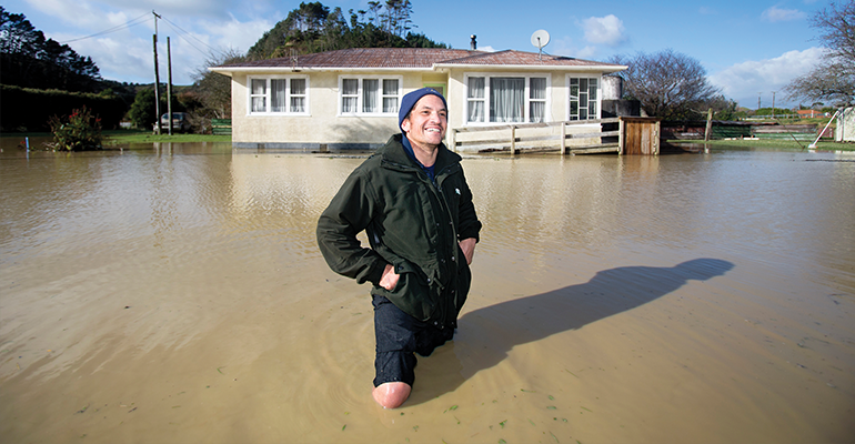
Floods are some of New Zealand’s most frequent, most damaging and most disruptive natural hazards. As our climate changes, flooding caused by both increased rainfall and rising sea levels – in coastal areas and on floodplains – is expected to increase.

As floods worsen, so will the social, cultural, economic and environmental consequences. Pinpointing exactly which areas are most at risk can be difficult, especially as extreme weather events become more frequent and less predictable.
There’s not a lot of information currently available to central and local government about exactly what infrastructure is at risk. The information produced through this research was needed urgently, and is needed on an ongoing basis, to help identify high-risk areas and prioritise mitigation and adaptation efforts.
This project produced flood maps and models to allow practitioners and researchers to identify how flood risk may evolve in their area. These models determine which assets – like buildings, roads, bridges and railway lines – are at risk, on both a regional and national level.
We created digital elevation models using data collected from councils across New Zealand. We completed coastal and fluvial/pluvial flood inundation mapping, as a crucial step towards developing a nationwide flood hazard map.
If we can accurately predict the areas of highest risk, we can adapt, minimising harm to New Zealand’s population and economy.
This project in the media:
- Rising tides put up to 94 schools at risk of flooding and closures Stuff
- People, roads and billions in assets vulnerable to climate change-related floods, Stuff
- New reports map cost of flood risk under climate change, TVNZ
- Huge risk from rivers and rising seas, Radio NZ Morning Report
- New reports map cost of flood risk under climate change, Radio NZ
- Rising seas: NZ must ‘put brakes on’ coastal development, NZ Herald
- River flooding in Canterbury potentially most damaging in NZ, Stuff
- New NIWA study shows 800,000 Kiwis at risk of flooding in coastal areas, NewsHub
- 7000 buildings at risk for every 10cm sea level rise, Newsroom
- 125,000 buildings at risk from first metre of sea level rise, Newsroom
- Reports warn about devastating impact of climate change on properties, Insurance Business NZ
- New Zealand: New reports highlight flood risk under climate change, Prevention Web (UNDRR)
- Climate change costs are hitting households through insurance premiums, Stuff
- NZ close to breaking record for annual storm damage cost only halfway through 2018, TVNZ
- Funding announced for climate resilience research, Scoop.co.nz
PROJECT TEAM
-
Ryan Paulik
NIWA -
Rob Bell
NIWA -
Daniel Collins
Independent consultant -
Scott Stephens
NIWA -
Ben Robinson
NIWA -
Sanjay Wadhwa
NIWA -
Sam Dean
NIWA -
Gabriella Turek
NIWA