Marae
Climate Impacts
Farms, whenua & awa
Communities
- Vision Mātauranga
Research Programme
- Robert McClean
Te Rūnanga o Ngāti Toa Rangatira - Ashleigh Sagar
Te Rūnanga o Ngāti Toa Rangatira - View the full team
Project Leaders
-
Budget
$250,000 -
Duration
January 2022 – February 2024
-
Completed project
Research Project
Te Ara o Raukawa Moana
Active kaitiakitanga in response to climate change
Ko Te Rauparaha te rangatira o Kāpiti me Te Moana-a-Raukawa
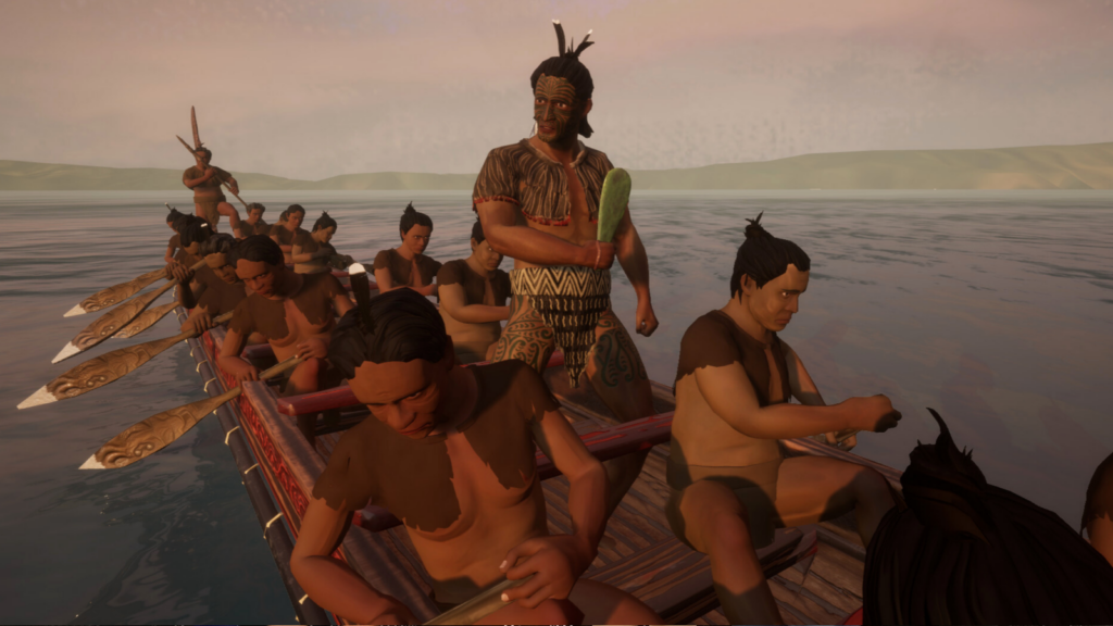
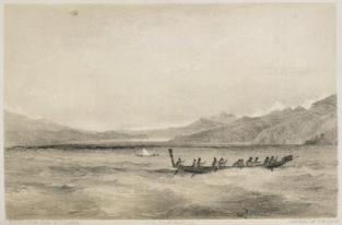
Raukawa Moana, the Cook Strait, is of the highest cultural and spiritual significance to Ngāti Toa Rangatira. Our seafaring and waka histories and traditions enabled travel across the sea highway for raupatu, trade, seasonal customory harvesting, events and whānau. Te Ara o Raukawa Moana was a research project of Ngāti Toa Rangatira to enable active kaitiakitanga at Raukawa Moana (Cook Strait) in response to climate change.
Our waterways, coasts and seas have been compromised by environmental degradation. Sacred waters have been buried under land reclamation and polluted by discharges. Climate change is further drowning our significant coastal places.
Our research project responded to climate change by drawing on our long history of ocean navigation, waka and our mātauranga which is based in and emerges from Raukawa Moana. Our responsibility towards the environment is an ancestral inherited right and central to cultural identity and resilience of Ngāti Toa Rangatira.
Our research brought together kaumātua and rangatahi, as well as other iwi members, to understand and plan for climate impacts on our significant coastal sites (such as islands, pā and urupā).
Our research also sought to ensure that iwi connections with our isolated coastal places were deeply understood as the basis for adaptation planning and environmental monitoring. These connections are visible in our ability to access and occupy our whenua and motu, in the health of our kaimoana and our moana, and in our mātauranga.
We will identified and reinvigorated tohu moana, and through mahi toi, gave them a modern expression, to ensure they are understood and can be incorporated into our planning frameworks.
Coastal markers, rocks and pou were a critical part of the Raukawa Moana tradition. On the coast north of Papanui (Boom Rock) was an ‘escape route’ called Te Ara Taura, which was a rope stairway used to climb up and down a rocky cliff when the tide was high, and when travelling along the coast, especially in times of trouble to gain access over to Te Tau Ihu.
In this example, mahi toi associated with Te Ara Taura served as:
- A marker of sea level rise (including from the late 1800s to now)
- A tool to ‘visualise’ sea level rise over the next 15-80 years
- An aid to wānanga the past and present ‘state’ of the climate – drawing together many kinds of embodied knowledges
- An aid to trigger and guide kōrero around new adaptation decisions.
Our research included voyages across Raukawa Moana to bring to life the knowledge we have gained throughout the research process.
PROJECT TEAM
-
Robert McClean
Te Rūnanga o Ngāti Toa Rangatira -
Ashleigh Sagar
Te Rūnanga o Ngāti Toa Rangatira -
George Elkington
Te Rūnanga o Ngāti Toa Rangatira -
Tracey Williams
Te Rūnanga o Ngāti Toa Rangatira -
Johnny Joseph
Te Rūnanga o Ngāti Toa Rangatira -
Wiremu Grace
Te Rūnanga o Ngāti Toa Rangatira