Marae
Farms, whenua & awa
Communities
- Vision Mātauranga
Research Programme
- Huhana Smith
Massey University - View the full team
Project Lead
-
Budget
$300,000 -
Duration
August 2017-July 2019
-
Completed project
Research Project
Risk management for Māori coastal assets
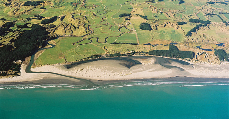
Coastal Māori farming communities are already affected by sea level rise. Erosion of the beach and even the collapse of some coastal infrastructure during storms is happening in several parts of the country. Effects such as flooding due to rising groundwater are subtler and more widespread.
This project built on the significant collective knowledge about climate change risks and opportunities built throughout 2015–17 in the rohe of Horowhenua– Kāpiti. This second phase of our project aimed to take another step towards change: co-developing Transition Action Plans that, given local conditions, focused on enabling Māori communities throughout Aotearoa New Zealand to assess the risks and benefits of alternative coastal land use.
In the first phase of our project, we combined data about soil, floods, topography, river sedimentation and sea level rise to identify the most vulnerable areas of our coastal farms. We also used an interdisciplinary approach to identify indicators of change and staged strategies for adaptation. The second phase examined physical processes such as future change in groundwater levels, and identified a wider range of options for managing wetlands and landscapes.
Although multiple reports have been produced about coastal erosion risks – including by local and regional councils – none have highlighted social engagement processes that could lead to effective community action. Our Māori-led interdisciplinary action research approach prioritised social engagement when considering how to respond to sea level rise and other climate change impacts.
This project in the media:
- Māori are among the most vulnerable to climate change, Stuff NZ
- Seven projects advance Māori climate research, Radio NZ
- The third Wai o Papa Exhibition: A project of hope for Māori Coastal communities, Deep South Challenge
- Breaking the ice, NIWA
PROJECT TEAM
-
Huhana Smith
Massey University -
Moira Poutama
Taiao Raukawa -
Aroha Spinks
Taiao Raukawa -
Murray Patterson
-
Jane Richardson
-
Derrylea Hardy
-
Martin Manning
-
Penny Allan
-
Bruce Glavovic
Massey University -
Jagadish Thaker
Massey University