What is Climate Change?
- Earth System Modelling & Prediction
Research Programme
- Stephen Stuart
NIWA - View the full team
Project Lead
-
Budget
$200,000 -
Duration
July 2019 – June 2023
-
Completed project
Research Project
Very high-resolution climate modelling for rain and wind
Heavy rainfall and extreme winds are increasingly impacting communities in New Zealand, and as they occur on such local scales, traditional atmospheric models struggle to represent these weather processes.
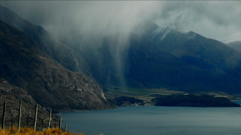
New Zealand weather systems are strongly influenced by the Southern Alps, where coarse model resolution can result in rainfall being simulated in the wrong river catchments. Very high-resolution modelling is refining our understanding of these weather processes, and will contribute to improved projections of New Zealand’s future climate.
This project developed very-high resolution modelling capability (2.2 km), and focused its analysis on key weather processes in NZ that occur on small spatial scales, such as rainfall triggered by moisture-laden air being forced over mountain ranges, extreme winds and intense low-pressure systems.
Key outcomes:
- A regional climate model has been configured for New Zealand at a 2.2 km grid spacing, allowing the complex mountainous terrain of New Zealand to be better represented. Analysing historical simulations, the model shows improvement in the representation of important weather phenomena such as intense short-duration rainfall.
- The New Zealand Earth System Model (NZESM) has been successfully downscaled to 2.2km over NZ in a multi-year simulation (beginning in 2080) under a high-emissions warming scenario (SSP3-7.0).
How this research can be used:
- Very high-resolution climate simulations are providing new insight into the behaviours of rainfall, snow and wind in New Zealand, particularly in alpine regions, and how these may change under future warming caused by increased greenhouse gases.
- This modelling will ultimately be used to improve future projections of a range of downstream environmental processes including river flows and flooding.
Very high-resolution climate modelling: 2022 – 2023
$50,000
A Regional Climate Model (RCM) of New Zealand was further developed at a very high spatial resolution of 2.2 km. This RCM is based on the Unified Model (UM) developed by the UK Met Office. Relative to coarser RCMs, this model exhibits more realism in several key aspects of NZ weather, including intense short-duration rainfall, mountain precipitation and possibly also surface wind speeds.
The representation of these and other meteorological phenomena relevant to climate change impacts will be further investigated in model simulations. This RCM has already been successfully used to downscale the New Zealand Earth System Model (NZESM) to 2.2km resolution over NZ in a multi-year simulation under a high-emissions future warming scenario. Utilising additional resources from NIWA’s core funding, the extension of this project will consolidate its recent advances in very high-resolution climate modelling in New Zealand.
Very high-resolution downscaling of the NZESM: 2019 – 2022
$150,000
The aim of this project was to develop a climate model for New Zealand at a very high spatial resolution of around 1 to 2.5 km. At this resolution, the steep, complex terrain of New Zealand is well resolved.
This improves the simulation of rainfall over mountain catchments, which is critical to national water resources. The model can also explicitly represent some small-scale vertical air movements, called convection, which influence the development of clouds and heavy rainfall events. This model is therefore termed a convection-permitting model (CPM). The CPM has been linked to the New Zealand Earth System Model (NZESM), via an intermediate regional climate model (RCM) running at a spatial resolution of 12 km.
Simulating climate at this fine spatial scale requires huge computational resources, particularly if the model spans the whole of New Zealand, and takes some years to develop. The CPM was therefore experimental to begin with: simulations were restricted to short time-slices and, if necessary, geographic sub-regions of the country.
-
Stephen Stuart
NIWA -
Abha Sood
NIWA